
 Web Development
 Data Science
 Python
 SQL
 JavaScript
 Artificial Intelligence
 IT & Software
 IT Certifications
 Hacking
 AWS
 Arduino
 DevOps
 3D Modeling
 Graphic Design
 Photoshop
 Drawing
 Digital Painting
 UX Design
 Business
 Data Analysis
 Communication Skills
 Project Management
 Leadership & Management
 Human Resources
 Digital Marketing
 Social Media Marketing
 Marketing
 SEO
 Google Analytics
 Branding
 Excel
 Office Productivity
 SAP
 PowerPoint
 Microsoft Access
 SharePoint
 Finance & Accounting
 Trading & Investing
 Accounting
 Bitcoin
 Personal Finance
 Video Editing & Animation
 Photography
 Adobe Premier Pro
 Adobe Lightroom
 Personal Development
 Productivity
 Career Development
 Life Coaching
 Health & Fitness
 Meditation & Mindfulness
 Yoga
 Music
 Music Production
 Guitar
 Piano
 Singing
 Language Learning
 Teaching & Academics
 Engineering
 Math
 Lifestyle
Introduction to Spatial Databases with PostGIS and QGIS 3 (Udemy.com)
Learn Spatial SQL and database management for GIS Professionals
Created by: Michael Miller
Last updated May 2020
 What you will learn
- Understand the advantages of storing spatial information in spatially enabled databases
- Install PostGIS locally for development purposes and/or access an instance of PostGIS that is running on their organizations intranet, a web host, or the cloud
- Write SQL queries to retrieve and analyze spatial data.
- Use the tools available in PostGIS to validate data and control user access
- Perform basic database administration functions to keep your spatial database running smoothly
How it compares
Against the other 1,182 rated Udemy courses in IT & Software on CourseDuck:
- Rating4.4 out of 5higher than 30% of them
- Reviews1,361#327 of 1,183 by number of reviews
- Length12.7 hourslonger than 78% of them
- Last updatedMay 2020earlier than 85% of them
 Course Description
This course is intended to provide an introduction to spatial databases in general and PostGIS in particular to GIS professionals who are interested in expanding their skillset to multi-user enterprise level spatial databases. This course uses the latest (as of 2/18) versions of PostgreSQL (10.1), PostGIS (2.4), and QGIS (3.0). I believe it is the most current and thorough course on spatial databases available today. You will learn
- What a spatial database is and why you would want to use one.
- What SQL is, why you would want to use it, and how it can be applied to geospatial concepts.
- How to install PostGIS locally for development purposes and how to access a production version via a network or the internet.
- How to load your spatial data into PostGIS and access it from a variety of clients, especially QGIS
- The basics of SQL for both spatial and non-spatial queries
- How to validate data and control user access with the tools built-in to PostGIS
- Optimizing your queries for the best performance
- How to work with raster data in PostGIS
- The basics of programming custom functions with PL/pgSQL
- The basics of database administration to keep your database operating smoothly

 Udemy Discount
The discount is applied through our link. Open the course from here and Udemy's current promotional price is applied at checkout on most courses, no code to type.
Some courses are excluded from Udemy's promotions. If the price does not drop, clear your browser cookies and use the button again.
Instructor Details

- 4.4 Rating
 1,361 Reviews
Michael Miller
I have been programming and working with database applications for over 30 years, and specializing in geospatial applications for over 20 years. I am a believer in the 80/20 pareto principle which suggests that you only need to understand 20% of a subject in order to do 80% of your work. My goal in all my courses is to teach at the level of that 20% sweet spot and to provide my students with the background and the tools they need to learn the rest of what they need on their own.
 More courses by Michael Miller
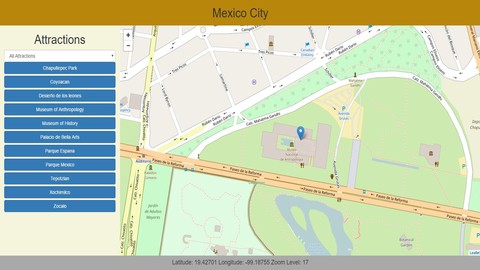
Introduction to web programming for GIS applications (2019)
4.6 (1,594 Reviews)
 Provider: Udemy
 Time: 14.7h
$10.99
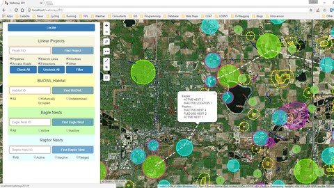
Display and analyze GIS data on the web with Leaflet (2019)
4.6 (848 Reviews)
- Provider: Udemy
- Time: 13.7h
$11.99
More IT & Software courses

D3.js Data Visualization Fundamentals - Hands On (2026)
4.9 (3,917 Reviews)
- Provider: Udemy
- Time: 4.6h
$49.99

Hands-On Training: Streaming Data with Apache Kafka on Azure (2025)
4.9 (103 Reviews)
- Provider: Udemy
- Time: 3.7h
$10.99

Oracle Grid Infrastructure and RAC using Oracle Database 19c (2026)
4.8 (2,499 Reviews)
- Provider: Udemy
- Time: 8.7h
$19.99

PowerShell Scripting & Automation: The Complete Hands-On (2026)
4.8 (1,750 Reviews)
- Provider: Udemy
- Time: 9.6h
$11.99
AWS EC2 Crash Course + Load Balancing with Demos and PDFs (2025)
4.8 (866 Reviews)
- Provider: Udemy
- Time: 3.7h
$19.99
 Reviews

By ADRIAN GERARDO RODRIGUEZ MEZA on 1/3/2022
Aunque tiene mucho margen de mejora en la edición y locución del video, el contenido que presenta es basto y muy específico para los que estamos enfocados en la programación GIS, fue muy interesante y pude aprender mucho del mismo. Pdta: Escribo esta reseña en español para que sepan que no hay dificultad en el idioma, los ejercicios son bastante prácticos además que está la opción de subtítulos que, aunque no son correctos, puedes llegar a comprender si tienes una noción básica del Inglés.
By Miguel Imperial on 2/4/2021
I would appreciate if Mike updates the presentation. There are times where he should visualize the items he's discussing by annotating, making diagrams, etc. instead of simply talking about it. But I highly recommend this course for the GIS professionals out there who are still used in the mapping and cartography side of GIS and want (or need) to upgrade to the database aspect of GIS. You learn a lot about the course through his examples which are "sample" scenarios that a GIS specialist would encounter. I like that he shows the errors he encounter which is a good resource on not what to do.
By Thomas Meyer on 1/11/2021
I very enjoyed the way how Mike is explaning the topic and is giving you good examples based on the provided data sets. I would like to have more opportunities to check my knowledge with some small exercises, but for a beginner in SQL this course is the right one to choose. It gives you a good overview of the possible tools and codes you could/should use during the managment of your data base. Many thanks!
By Ronald Ingraham on 12/16/2020
Very long course, but the content was fantastic. Clear and concise. Only suggestion is that the data provided for this course, specifically the header column names match those for the course. There were 2, but I can only remember one (I think), which was raptor_surveys->user. I "think" in the course this was supposed to be "surveyor". But please, do not let this minor glitch at all sway you from taking this course. If you want to learn PostGIS, this is a fantastic course and will cover the basics, plus much more.
By Zachary Clark on 9/16/2020
I would have liked to have more "challenge scenarios" than what was given in this course. It would have been much more helpful to have a "quiz" / "challenge scenario" at the end of each section. There were only 2-3 sections with challenges and they asked vague questions. Several sections were covered very quickly and the overall presentation was dry. I did learn some about PostGIS and SQL, and I would probably take another course from this instructor if it was offered at a discounted price.
By J R on 8/21/2020
Really amazing content. Compared to another course on a similar subject, this is hands down the most comprehensive and most thought out course I've ever taken online. Very good at teaching and explaining things in a clear understandable manner. If I were to find a negative, there is TOO much content here! But that's a good thing, so there isn't a negative. This most definitely will help me in my career goals without a doubt! I will certainly take more courses from this teacher!
By Taylor Hixson on 5/31/2020
A fantastic course and phenomenal instructor! I always wanted to get started with PostGIS to maximize my use of GIS, and now, I feel confident that I can and already am. I took this course using a Mac, but I was still able to complete the course examples and follow along with Mike's guidance. This topic can be kind of heavy, but I felt like everything was made so clear and there were good, practical examples. I will absolutely be taking more of Mike's courses. These are absolutely worth it.
By Andrew Grandison on 8/15/2019
I think that the course really good at showcasing the broad use cases for a spatial database, and as well how to do common tasks using SQL in the spatial database. The final section for deploying a database was as well informative. I think that the course could use some graphics to better explain some things, and as well give more examples on how to best use the functions. However, I do think that coding is best taught and this course gives the student the right access to the right information to start their own discovery of the GIS/Spatial database tools available.
By Walid Moulahoum on 11/27/2018
The course is very good in terms of explanation which goes to detail. I enjoyed that the instructor went through the different functions and provided examples of comparison of results which is very helpful to decide on processing methods when we're facing real world problems. The course is pretty thorough and covers the most important components needed to start working with databases and deploying them on the web. The SQL part was a bit dragged but all in all it was good. All in all the course is very good and I didn't find many available courses out there that deals with spatial databases to this level of detail. I am very satisfied with the content. As I like feedback, I have a couple of improvements I would like to suggest in order to improve the content and delivery of this particular course: 1- It would be nice if there a clear introduction to the datasets, maybe to give contexts and understand the information in the DB 2- It would be nice if the course is set up in a format of a project. Initially you could set up a scenario where a client comes with a request and you highlight the objectives and then move step by step to the methods required to solve the problems. I have to admit that I was a bit disappointed to see that as certain points the manipulations were only for demonstrations and didn't have any particular objective. 3- The last part which was very interesting was very theoretical. I wish the pl/pgsql and the automation parts were given with at least an example or two. I found it quite disappointing to learn about procdural language just through a slide especially with triggers which I believe is a very important part of the course. 4- I'm not sure where I stand with this, but are there any free hosting options that you could have perhaps used for hands on practice. I think QGIS cloud could be a nice add. It's nice to see a demonstration of the hosting services that are out there for the purpose of real world cases, but it wold have been nice to have some exercises concerning that part
By Eran Grossman on 8/26/2018
The lecturer makes the learning material comprehensive and addresses the GIS experienced community. I think it would be a better if the course addressed a couple of more topics: multi-user editing, archiving, conflicts etc.; handling rasters - uploading to database, functions etc; making GIS oriented online applications. Also I think that the course would be enriched having more challenges along the way. Besides the above remarks I've found the course as a great bundle of down-to-earth materials wrapped to address an oriented GIS specialist with little experience fully functional databases like myself.
 Quality Score
No CourseDuck member has rated this course yet. Taken it? Give each part a thumbs up or down.
Overall Score : 88 / 100
- Video Duration:
 12.7h
- Price: $10.99
- Provider: Udemy
- Updated:
 May 2020
- Level:
 Intermediate
- Language:
 English
- Certificate:
 Yes
30-day money-back guarantee on most paid courses
Udemy Coupon Price Tracker
